File:Aberdeen, Salvation Army Citadel - geograph.org.uk - 1958642.jpg
Jump to navigation
Jump to search
Size of this preview: 800 × 600 pixels. Other resolutions: 320 × 240 pixels | 640 × 480 pixels | 1,024 × 768 pixels | 1,280 × 960 pixels | 1,600 × 1,200 pixels.
Original file (1,600 × 1,200 pixels, file size: 713 KB, MIME type: image/jpeg)
Summary
| Description |
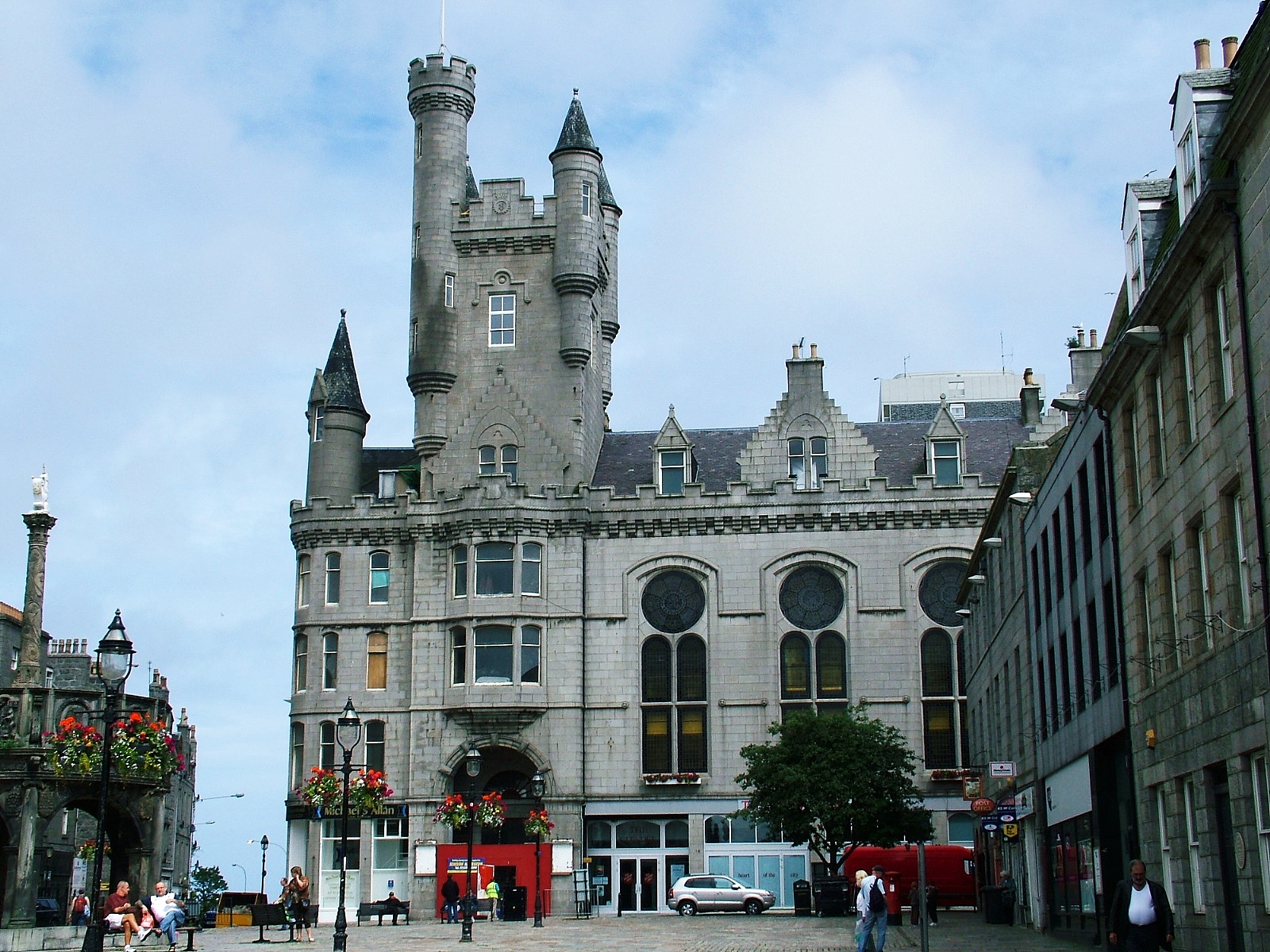
English: Aberdeen, Salvation Army Citadel. Aberdeen Salvation Army Citadel, built 1893-96 (architect James Souttar - http://en.wikipedia.org/wiki/James_Souttar ), at the east end of the Castlegate. |
| Date | |
| Source | From geograph.org.uk; transferred by User:Ultra7 using geograph_org2commons. |
| Author | Greig Ritchie |
| Permission (Reusing this file) |
Creative Commons Attribution Share-alike license 2.0 |
| Attribution (required by the license) | Greig Ritchie / Aberdeen, Salvation Army Citadel / |
| Camera location | | View this and other nearby images on: OpenStreetMap |
|---|
| Object location | | View this and other nearby images on: OpenStreetMap |
|---|
_region:GB-GBN_heading:67.00&language=en)
Licensing

|
This image was taken from the Geograph project collection. See this photograph's page on the Geograph website for the photographer's contact details. The copyright on this image is owned by Greig Ritchie and is licensed for reuse under the Creative Commons Attribution-ShareAlike 2.0 license.
|
This file is licensed under the Creative Commons Attribution-Share Alike 2.0 Generic license.
Attribution: Greig Ritchie
- You are free:
- to share – to copy, distribute and transmit the work
- to remix – to adapt the work
- Under the following conditions:
- attribution – You must give appropriate credit, provide a link to the license, and indicate if changes were made. You may do so in any reasonable manner, but not in any way that suggests the licensor endorses you or your use.
- share alike – If you remix, transform, or build upon the material, you must distribute your contributions under the same or compatible license as the original.
File history
Click on a date/time to view the file as it appeared at that time.
| Date/Time | Thumbnail | Dimensions | User | Comment | |
|---|---|---|---|---|---|
| current | 19:06, 16 September 2012 | | 1,600 × 1,200 (713 KB) | wikimediacommons>File Upload Bot (Magnus Manske) |
File usage
There are no pages that use this file.